Your baseline already exists.
The satellites recorded it.
When a neighbor alleges that your works cracked their building, the dispute reduces to one question: what did that structure do before you broke ground? A dated movement record answers it. The satellite archive lets you establish one now — the data exists, whether or not anyone watched.
Three reasons baselines get commissioned
Design input
Ground that already moves changes the foundation choice, the settlement allowance, and the phasing. Movement found during construction costs far more than movement found during design.
Claims defense
Damage claims turn on cause and timing. A record that shows the structure sank for years before your works began gives you a defensible position instead of a negotiation in the dark.
Neighbor relations
Share the pre-works record with adjacent owners before the excavation starts. The future argument becomes a present fact — both sides know the start condition.
The retroactive baseline
Traditional baselines — crack gauges, survey benchmarks, tiltmeters — record only from installation day forward, so you must plan them before the works. The radar archive removes that constraint. Sentinel-1 measured every site every 6–12 days from 2015 on, so you can reconstruct a screening-grade movement history of your site and its neighbors after the fact — from data collected before anyone thought to ask. Each analysis is frozen with its processing record: tool versions, parameters, acquisition dates. That record makes it a dated exhibit rather than a screenshot.
The honest boundary: screening-grade radar evidence documents the movement of stable radar reflectors — rooftops, pavement, structures. It does not replace the pre-condition photographic survey. It does not replace the instrumentation your geotechnical engineer specifies for the excavation, or engineering judgment about cause. It is the historical layer that those tools cannot provide.
When to establish it
Establish it before mobilization, best at bid stage — it is also a bid input ("the ground moves; price accordingly"). The archive is retroactive, so "we already started" does not mean "too late": the pre-works record still sits in the archive, and we can still process it. Only one record has no retroactive rescue — the works period itself, if nobody processes the new passes. Monitoring during construction is a subscription question, not an archive one.
The deliverable
The report your client sees
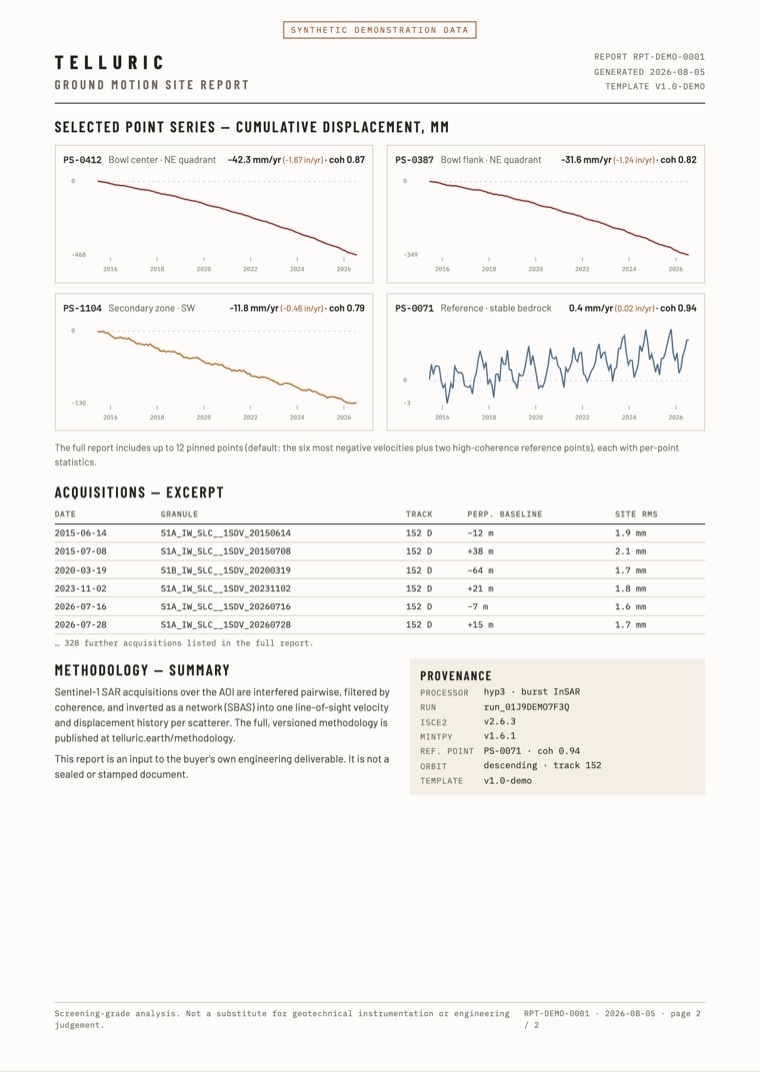
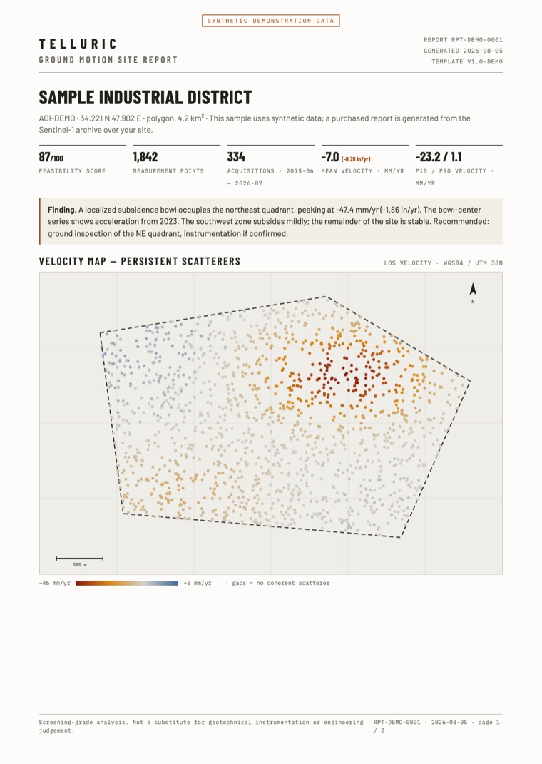
Dated, branded, and traceable: the velocity map, the movement history of every selected point, the acquisition list, and the full processing record. It goes inside your deliverable — it does not replace it.
PDF · two pages · synthetic demonstration data
Establish your baseline
Draw your site, and you get a free feasibility report from the Sentinel-1 radar archive in about one minute. It tells you how many passes cover the site, how often, over what period — and if the satellites can measure it at all. If they cannot, the report says so.
Check your site freeTelluric readings come from satellite radar and are screening-grade: use them to decide where to inspect. They do not replace geotechnical instrumentation or engineering judgment. Read the methodology.