What does an
InSAR survey cost?
A commissioned InSAR study from a specialist consultancy typically costs $10,000–30,000 per site and takes several weeks. A screening-grade self-serve report on the same public satellite archive costs $749 per site and arrives in about a day. Both prices are rational — they buy different things. Here is the honest breakdown.
Why commissioned studies cost five figures
The satellite data itself is free. Sentinel-1 radar imagery is public, covers every site on Earth every 6–12 days, and reaches back to 2015. A specialist consultancy charges for the work around the data: custom processing tuned to your site, expert interpretation, quality assurance, and a written engineering opinion. Their professional liability stands behind the result. That is skilled labor, and it is priced like consulting because it is consulting.
For a safety-critical asset — a dam, a tailings facility, a tunnel under construction — buy that interpretation layer. Screening tools do not replace it.
What screening-grade analysis costs
| Option | Price | You get |
|---|---|---|
| Feasibility check | Free | Tells you if the satellites can measure your site reliably, and what the radar archive holds over it |
| Site report | $749 one-time | The full movement history for one site up to 25 km² — per-cell rates, time series, and a PDF report |
| Professional subscription | $429 / month | Two new site reports per month, up to 10 active sites, and quarterly refreshes of every baseline |
| Commissioned study | Typically $10,000–30,000 | Custom processing plus expert interpretation and an engineering opinion — the right buy for safety-critical assets |
The economics are simple: one more site from a public archive costs the automated pipeline tens of dollars, not thousands. The self-serve report deliberately excludes interpretation. The output is screening-grade evidence — an input to your engineer's judgment, not an engineering opinion.
Which one do you need?
A practical rule: if the question is "should we look closer at this ground before we bid, buy, design, or litigate?" — that is a screening question. Most projects skip it entirely, because consulting prices are too high for it. If the question is "is this specific asset safe?" — commission the study, engage the specialist, and instrument the site. Many of our users do both, in that order: run the check on ten candidate sites for hundreds of dollars, then commission deep work on the one that warrants it.
The deliverable
The report your client sees
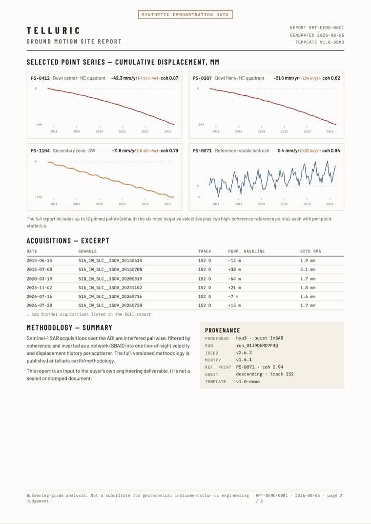
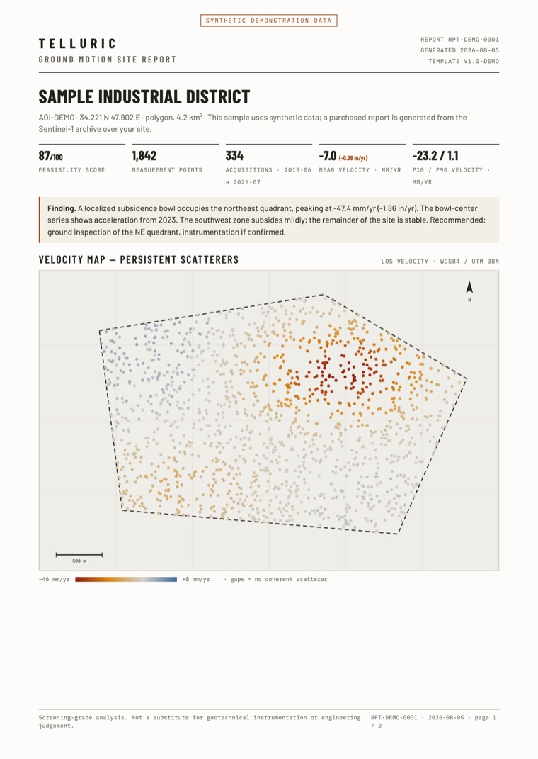
Dated, branded, and traceable: the velocity map, the movement history of every selected point, the acquisition list, and the full processing record. It goes inside your deliverable — it does not replace it.
PDF · two pages · synthetic demonstration data
Price your site at $0 first
Draw your site, and you get a free feasibility report from the Sentinel-1 radar archive in about one minute. It tells you how many passes cover the site, how often, over what period — and if the satellites can measure it at all. If they cannot, the report says so.
Check your site freeTelluric readings come from satellite radar and are screening-grade: use them to decide where to inspect. They do not replace geotechnical instrumentation or engineering judgment. Read the methodology.