Satellite radar vs
traditional survey
Leveling, total stations, and GNSS measure ground movement precisely — from the day you install them. Satellite radar measures it retroactively — the archive holds a record of every site back to 2015. They answer different questions. The honest comparison asks which question you have.
The comparison, dimension by dimension
| Dimension | Traditional survey (leveling / total station / GNSS) | Satellite InSAR |
|---|---|---|
| History | Starts on the day you install the instruments — there is no record before that | Retroactive: the Sentinel-1 archive reaches back to 2015 for almost any site |
| Precision | Sub-millimeter locally (precise leveling); millimeters (GNSS) | Millimeter-scale rates over multi-year series, along the radar line of sight |
| Coverage | The benchmarks you install — dozens of points, where you chose to put them | Every stable natural reflector — often thousands of points per km² in built areas |
| Cadence | Per campaign (quarterly/annual) or continuous with fixed GNSS | Every 6–12 days, automatically, indefinitely |
| Cost structure | Field crews and instruments — cost scales with site visits | Processing only — the data is free and already collected |
| Limits | No history before installation, and sparse spatial sampling | Fails over dense vegetation, water, and fast-changing surfaces. Measures along the radar line of sight, not pure vertical. Screening-grade, not an engineering opinion |
The one thing only the satellite can do
You cannot install a benchmark in the past. If the question involves history — did this parcel settle before we bought it, did that structure move before our works began — the radar archive is the only instrument that was already there. Satellite screening does not compete with survey crews. It answers the question that surveys cannot answer.
The converse is equally true. Where life safety depends on millimeters this week — an excavation next to a hospital, a dam drawdown — instrumentation with engineering supervision is the tool. No screening product replaces it. The strong pattern is a sequence: use the satellite history to decide where instruments are necessary, then install instruments where they earn their cost.
The deliverable
The report your client sees
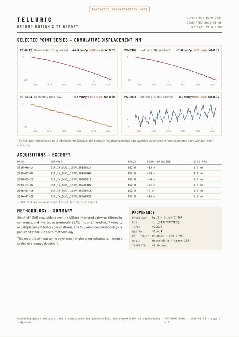
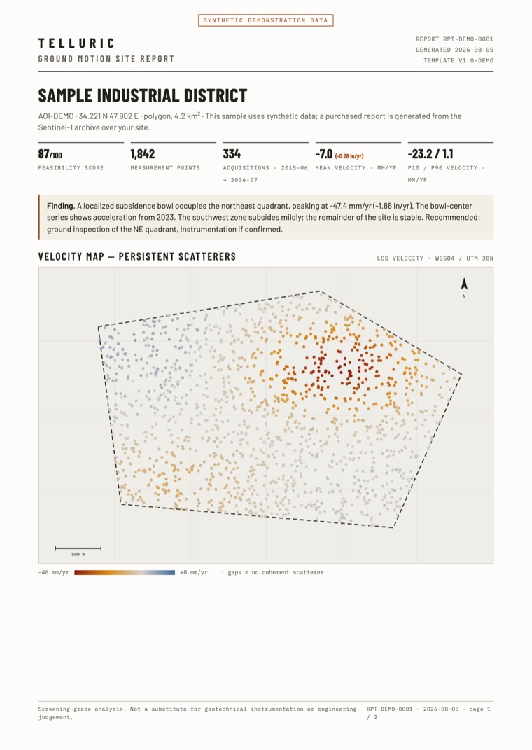
Dated, branded, and traceable: the velocity map, the movement history of every selected point, the acquisition list, and the full processing record. It goes inside your deliverable — it does not replace it.
PDF · two pages · synthetic demonstration data
Check your own site
Draw your site, and you get a free feasibility report from the Sentinel-1 radar archive in about one minute. It tells you how many passes cover the site, how often, over what period — and if the satellites can measure it at all. If they cannot, the report says so.
Check your site freeTelluric readings come from satellite radar and are screening-grade: use them to decide where to inspect. They do not replace geotechnical instrumentation or engineering judgment. Read the methodology.